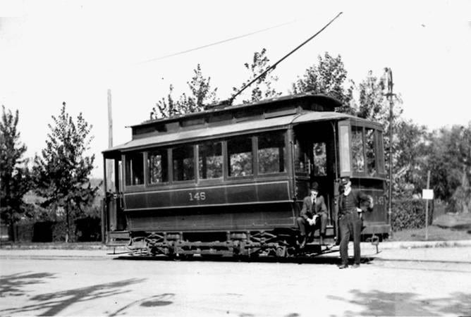
| 1890s | Trolley from Georgetown reached Wisconsin Avenue at Western Avenue |
| 1899 | AU Park, Montgomery County subdivided for development |
| 1910 | Boundary Avenue was constructed [now Western Avenue] |
| 1914 | Friendship Heights Village incorporated as a special tax district |
| 1925 | Louis Shoemaker’s heirs sold their 52-acre farm to Donald Woodward |
| 1930s | Wilbert subdivision was developed |
| 1938-43 | Cooper Lightbown Co. built 150 homes in Brookdale North and South |
| 1942-45 | During World War II the area next to Cortland Road, now the GEICO parking lot, was a victory garden |
| 1946 | Two separate sections of Overbrook Road were joined when four houses were built on the new piece between Newport and Keokuk |
| 1946-1947 | Orchardale subdivided for development |
| 1947-48 | Dover Court was built, with its homes |
| 1950 | Lord & Taylor and Woodward & Lothrop department stores opened at intersection of Wisconsin and Western avenues |
| 1953 | Chevy Chase shopping center built east of Wisconsin Avenue |
| 1957 | In a letter from a GEICO senior VP to the President of the Brookdale Citizens Association, GEICO made a series of promises in return for Brookdale’s support of GEICO’s application for limited development. Letter promised no road access to Brookdale, an 85-foot “green” buffer for Brookdale and said, “The Company has no intention of disposing of any of this land.” GEICO was granted commercial rezoning for the land under its building (only). Parking lots were allowed under special exception. |
| 1958 | Brookdale Citizens Association was incorporated by Paul Hawkins, Edward Nicholson, Jr., and Mary Murray |
| 1957-1962 | Jay Wohlfarth developed Wohlshire |
| 1962 | River Road widened from two to four lanes |
| 1964 | Saks Fifth Avenue opened |
| 1964 | West Chevy Chase Master Plan adopted: All of the GEICO site was allowed to be commercial except for an 85-foot strip along Cortland Road. GEICO did not apply for the rezoning |
| 1964-70s | Barlow, Polinger and Thelma Edwards developed Friendship Heights Village with high rises and commercial buildings |
| 1965-67 | Brookdale President, Campbell Graeub; Orchardale President, Sam Gordon |
| 1966 | Highland House, the Irene, and the Willoughby constructed. GEICO petitioned for additional parking lots, leading to controversy in January 1967 when GEICO cut its trees although approval had not been given. |
| 1969-70 | Brookdale President, George Hill |
| 1970-72 | Brookdale President, Sterling Ivison; Orchardale President, John Bartolomeo |
| 1971 | GEICO requested an extension of the Central Business District (CBD) to include its site (with zoning implications) |
| 1971 (Nov.) | The Orchardale Association merged with the Brookdale Association, then referred to as the Tri-Community (with Wohlshire) |
| 1972-73 | President, Norm Knopf |
| 1973-74 | President, Ed Aikman |
| 1974 | Sector Plan adopted: Recommended a scale-back of development related to the ability of feeder roads to serve the businesses. It removed 24 acres from the CBD and recommended no further development on the GEICO site. |
| 1974-76 | President, Lynn Sheridan |
| 1977 | Neiman Marcus/Mazza Gallerie opened |
| 1980 | Bill McElroy, Bob Cope, and Norm Knopf stopped development of a multi-story building in Boundary Park |
| 1984 | Friendship Heights Metro station opened (originally scheduled for 1976) |
| 1988 | Somerset House developed |
| 1990 | Chevy Chase Pavilion opened |
| 1992-94 | President, Bob Cope |
| 1994-95 | President, Marty Weigand |
| 1995-97 | President, Jim Norton |
| 1997-98 | President, Dave Montgomery |
| 1998 | New Friendship Heights Sector Plan was adopted, dominated by a policy that growth is encouraged around Metro Stations. Development was approved on three major sites: GEICO, “Wisconsin Place” on Hecht’s site (by New England Development), and “Chevy Chase Center,” east of Wisconsin Avenue (by Chevy Chase Land Company). |
| 1998-2000 | President, Allison Fultz |
| 2000-02 | President, Gwen Lewis |
| 2002-03 | President, William Geiger |
| 2003, 2004 | Construction began on “Chevy Chase Center,” then on “Wisconsin Place” |
| 2004-06 | President, Dave Montgomery |
| 2007-09 | President Steve Heyman |
| 2010 | President Marie Moylan |
| 2012-13 | President Diane Tanman |
| 2013 | GEICO’s Preliminary Plan for development (approved in 1999) extended for six more years. Plan includes 810,000 feet of office space, 300 multi-family units, and 200 townhomes, along with a 50-foot buffer zone between GEICO and Brookdale, and transfer of Brookdale Park to Montgomery County. |
| 2015 | 75th Anniversary celebration and Brookdale signs were installed at key entrances to the neighborhood |
| 2016 | President Richard Podolske |
| 2017 | Negotiation of revised Westbard Plan through the Montgomery County Planning Board. County and commercial proposals currently under consideration would increase development density and traffic, put additional pressure on schools, and potentially eliminate useful businesses such as gas stations and car repair sites. Brookdale Citizens voted to add part of Newport Avenue, Montgomery Avenue, and Keokuk Street to Brookdale South. |
| 2020 | Brookdale Community created the Park-Newport section, which combined Park Avenue and Park Place from Brookdale South with sections of Newport Street and Montgomery Avenue |
